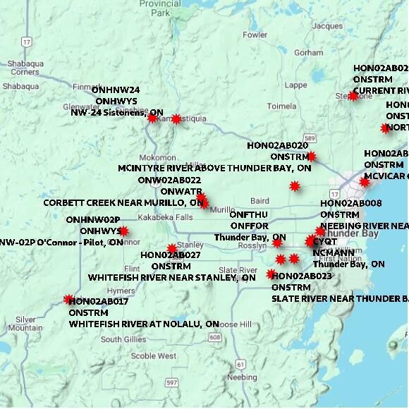
Google maps or look below for zoomed in maps and photos.
STATION ONW02AB022 CORBETT CREEK NEAR MURILLO ON elevation 304 metres Government of Ontario: Ministry of Natural Resources and Forestry
Map 60x60 km
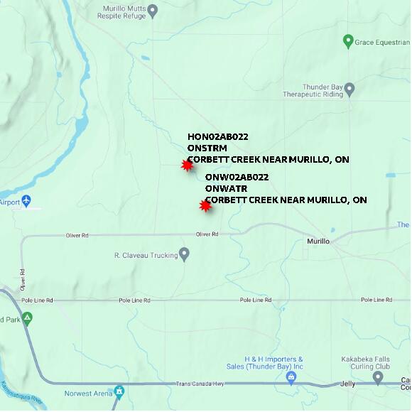
STATION ONW02AB022 CORBETT CREEK NEAR MURILLO ON elevation 304 metres Government of Ontario: Ministry of Natural Resources and Forestry
Map 10x10 km
STATION ONW02AB022 CORBETT CREEK NEAR MURILLO ON elevation 304 metres Government of Ontario: Ministry of Natural Resources and Forestry
Map 1x1 km
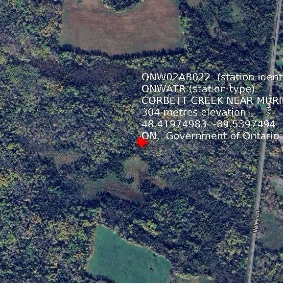
Google basemap data